Is your Facility's Digital Twin Identical, or a Distant Cousin?
Dec
15
10:00 AM10:00

Is your Facility's Digital Twin Identical, or a Distant Cousin?

We are excited to be introducing a new product from our software vendor, Esri, for indoor mapping of building facilities and campuses called ArcGIS Indoors.  It is a robust application which consumes CAD drawings, BIM models, or 3D scan data to create a centralized, interactive mapping interface of the interior space of your facilities providing benefits such as space management, interactive maps of interior spaces, indoor routing with turn-by-turn navigation, critical life-safety information for emergency responders, and a single source for storing as-built information to share with engineers, architects, and developers. We hear a lot about the digital twin and how it is supposed to be an exact replica of the actual building but many facility managers are struggling to make this happen. Now with ArcGIS Indoors there are more ways to make this a reality. Don’t miss out on this opportunity to view the latest indoor facilities solution.

View Event →
 Incorporating Survey123 into Collector with Related Records - Part 3 of 3
Nov
19
10:00 AM10:00

Incorporating Survey123 into Collector with Related Records - Part 3 of 3

In this 30 minute webinar, we’ll explore a workflow for utilizing Survey123 within the Collector Application for submitting survey forms as a form of related records. See how this workflow will allow your organization to migrate away from outdated, clunky, and paper forms to more efficient electronic inspection forms and records for your maintained assets.

View Event →
Parcel Fabric: Beef Up Your Workflows with ArcGIS Pro
Nov
4
10:00 AM10:00

Parcel Fabric: Beef Up Your Workflows with ArcGIS Pro

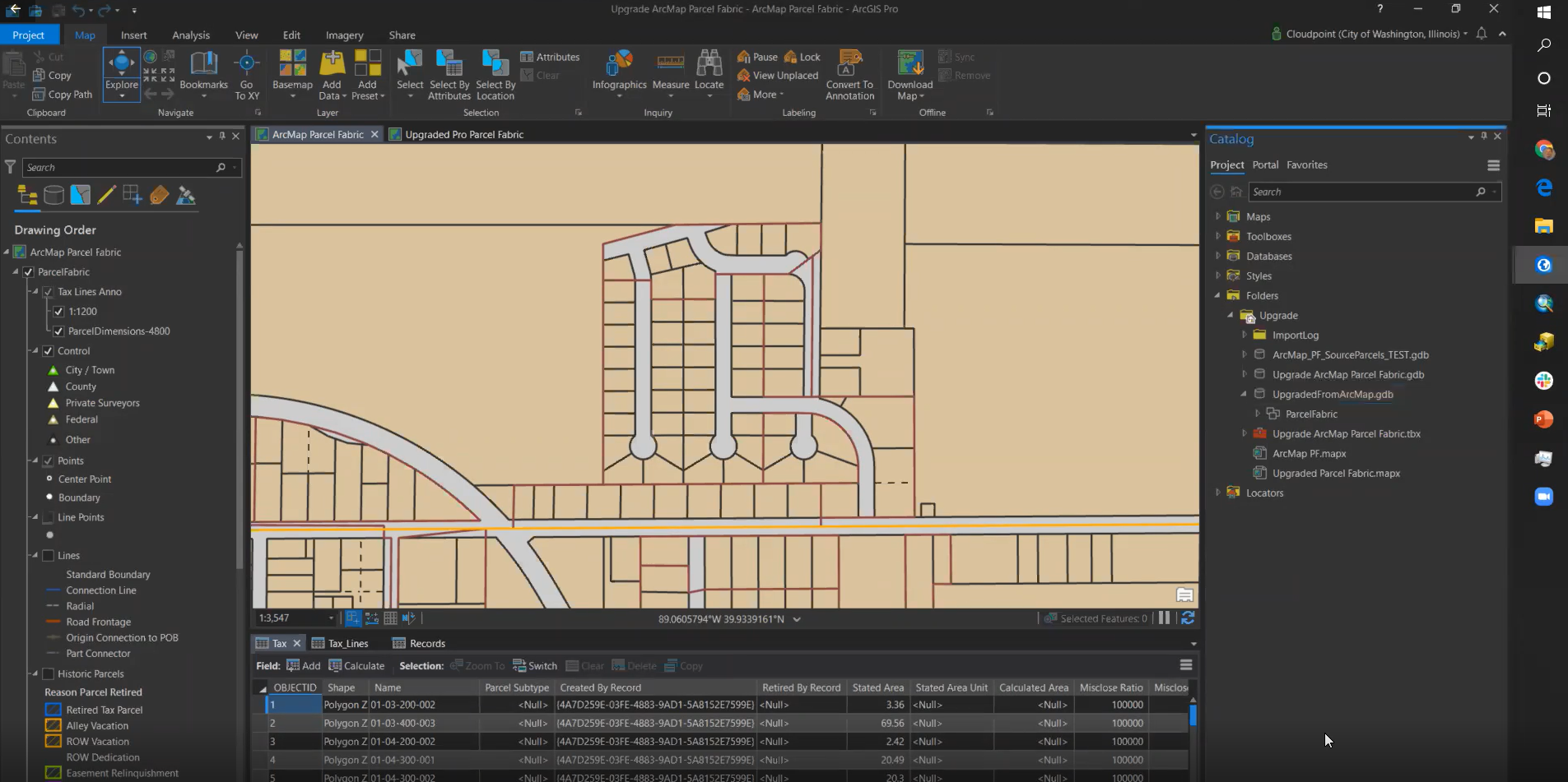
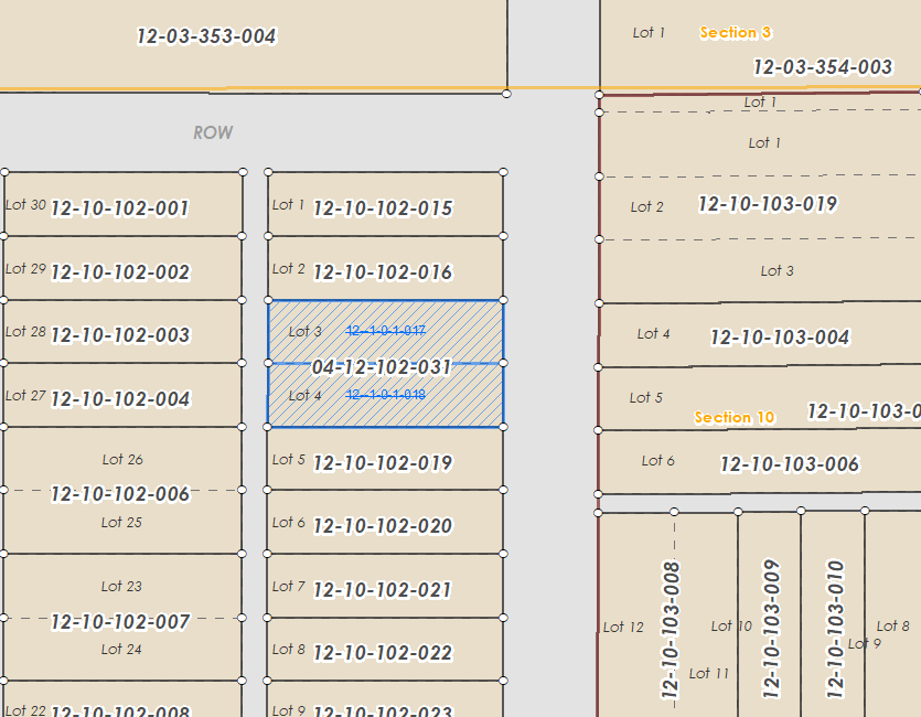
Take your Land Records to the next level with ArcGIS Pro! In this 30 minute webinar, learn how to create a new Parcel Fabric or migrate an existing Parcel Fabric from ArcMap. Find out the similarities and differences between an ArcGIS Pro and an ArcMap Parcel Fabric, and how to take advantage of the editing tools and workflows in Pro.

View Event →
Stay prepared with GIS: Fire prevention and incident planning
Oct
29
9:00 AM09:00

Stay prepared with GIS: Fire prevention and incident planning

Guest speakers: Daniel Moore (GIS Technician) & Matt Swaney (Public Information Officer) - Town of Normal, IL

Tired of bad building & facilities information? GIS indoor mapping is the blueprint of the future. Emergency personnel can now see inside facilities before arriving on-site. Let GIS & Indoor mapping answer the “What if’s” of your incident planning & preparedness. In this 30 minute webinar we are excited to introduce a new product from our software vendor, Esri, for indoor mapping of building facilities and campuses. It is a robust application which consumes CAD drawings, BIM models, or 3D scan data to create a centralized, interactive mapping interface of the interior space of your facilities providing benefits such as space management, interactive maps of interior spaces, indoor routing with turn-by-turn navigation, critical life-safety information for emergency responders, and a single source for storing as-built information to share with engineers, architects, and developers. Now you can finally access plans and as-built drawings through a highly detailed, interactive mapping interface.

View Event →
 Incorporating Logic and other Advanced Concepts in Survey123 Connect - Part 2 of 3
Sep
17
10:00 PM22:00

Incorporating Logic and other Advanced Concepts in Survey123 Connect - Part 2 of 3

In this 30 minute webinar, we’ll be exploring more in-depth capabilities and functionalities within Survey123 Connect with a focus on incorporating logic into Survey forms. More advanced concepts allow you to take your forms even further and allow end users to save time and effort when submitting responses.

View Event →
 Bye Bye ArcMap; Hello ArcGIS Pro!
Sep
15
9:00 PM21:00

Bye Bye ArcMap; Hello ArcGIS Pro!

This 30-minute session will help ArcGIS users embrace the transition to ArcGIS Pro from ArcMap. Many people have hesitations about making the transition and are somewhat resistant to the change. Attendees can expect to learn how to create new projects, import mxd’s into ArcGIS Pro, edit content from ArcGIS Online, and create new maps with layouts including map series (formerly known as Data Driven Pages).

View Event →
 Upgrading Your Enterprise GIS: What it Means and How to Keep Up
Sep
8
10:00 AM10:00

Upgrading Your Enterprise GIS: What it Means and How to Keep Up

What Version is your ArcGIS Server? Is ArcGIS Portal installed? Do you need to upgrade? How do you know what is best for your enterprise GIS? This 45 minute webinar will go over the most common best practice deployment scenarios. We will also discuss upgrade strategy and what Esri is doing with their releases. Attendees should be familiar with their own GIS system and what direction they want to take it. We will also be sure to allow some time for questions.

View Event →
Parcel Fabric: Find Your Flow Editing Parcels in ArcGIS Pro
Sep
2
11:00 AM11:00

Parcel Fabric: Find Your Flow Editing Parcels in ArcGIS Pro

Take your Land Records to the next level with ArcGIS Pro! In this 30 minute webinar, learn how to create a new Parcel Fabric or migrate an existing Parcel Fabric from ArcMap. Find out the similarities and differences between an ArcGIS Pro and an ArcMap Parcel Fabric, and how to take advantage of the editing tools and workflows in Pro.

View Event →
Creating Maps for Interior Spaces with ArcGIS Indoors!
Aug
31
10:00 AM10:00

Creating Maps for Interior Spaces with ArcGIS Indoors!

We are excited to be introducing a new product from our software vendor, Esri, for indoor mapping of building facilities and campuses called ArcGIS Indoors.  It is a robust application which consumes CAD drawings, BIM models, or 3D scan data to create a centralized, interactive mapping interface of the interior space of your facilities providing benefits such as space management, interactive maps of interior spaces, indoor routing with turn-by-turn navigation, critical life-safety information for emergency responders, and a single source for storing as-built information to share with engineers, architects, and developers. Now you can finally access all of your plans and as-built drawings through a highly detailed, interactive mapping interface. This tutorial will take a high-level view of the necessary components for getting your own facilities map up and moving and how you can begin laying the groundwork to make it happen. Don’t miss out on this opportunity to view the latest indoor facilities solution.

View Event →
Creating and Designing Survey Forms with Survey123 Connect - Part 1 of 3
Jul
21
10:00 AM10:00

Creating and Designing Survey Forms with Survey123 Connect - Part 1 of 3

Utilizing Survey123 Connect allows users to build and design more advanced and powerful surveys. This 30 minute webinar will demonstrate the essentials of using Survey123 Connect and how it can go above and beyond basic surveys. With the power of Survey123 Connect, you’ll be well on your way to creating powerful, intuitive surveys that benefit your organization.

View Event →
SignOps and GIS: Pointing the Way to Better Sign Management
Jul
9
9:00 AM09:00

SignOps and GIS: Pointing the Way to Better Sign Management

SignOps is the complete sign inventory management solution: enabling organizations and their users to manage their sign inventories in the cloud. With mobile capabilities, SignOps allows users the ability to access, update, and enter their sign data while working from the field. SignOps removes the hassle of tracking important information on pen and paper or all-encompassing asset management solutions, saving users time and effort. Join us for this short 30 minute webinar to learn how SignOps can help your organization by managing sign inventories through the cloud!

View Event →
NG911 and GIS: Make Sure Your Data Answers the Call
Jul
7
10:00 AM10:00

NG911 and GIS: Make Sure Your Data Answers the Call

None of us want to think about needing assistance for an emergency, but when the time comes, first responders need to know where you are and how to get there as quickly as possible. Join us for an interactive 30 minute webinar that will discuss the roll of GIS in an NG911 system, including the requirements, tips to meet those requirements, and tools for maintaining the data into the future.

View Event →
Introduction to Parcel Fabric in ArcGIS Pro
Jun
24
2:00 PM14:00

Introduction to Parcel Fabric in ArcGIS Pro

Take your Land Records to the next level with ArcGIS Pro! In this 30 minute webinar, learn how to create a new Parcel Fabric or migrate an existing Parcel Fabric from ArcMap. Find out the similarities and differences between an ArcGIS Pro and an ArcMap Parcel Fabric, and how to take advantage of the editing tools and workflows in Pro.

View Event →
GIS for Cemeteries: Helping Your Records, Maps, and Families
Jun
23
11:00 AM11:00

GIS for Cemeteries: Helping Your Records, Maps, and Families

This 30 minute webinar will help cemetery managers and staff understand the power of GIS and how it can help them manage cemetery records such as tracking sales and burial records using an user-friendly interactive mapping interface. Our professional staff will walk you through some capabilities that you may never thought were possible.

View Event →
Raising the Roof on Facility Mapping with ArcGIS Indoors!
Jun
12
10:00 AM10:00

Raising the Roof on Facility Mapping with ArcGIS Indoors!

We are excited to be introducing a new product from our software vendor, Esri, for indoor mapping of building facilities and campuses called ArcGIS Indoors.  It is a robust application which consumes CAD drawings, BIM models, or 3D scan data to create a centralized, interactive mapping interface of the interior space of your facilities providing benefits such as space management, interactive maps of interior spaces, indoor routing with turn-by-turn navigation, critical life-safety information for emergency responders, and a single source for storing as-built information to share with engineers, architects, and developers. Now you can finally access all of your plans and as-built drawings through a highly detailed, interactive mapping interface. This tutorial will take a high-level view of the necessary components for getting your own facilities map up and moving and how you can begin laying the groundwork to make it happen. Don’t miss out on this opportunity to view the latest indoor facilities solution.

View Event →
 Upgrading Your Enterprise GIS: What it Means and How to Keep Up.
May
26
11:00 AM11:00

Upgrading Your Enterprise GIS: What it Means and How to Keep Up.

What Version is your ArcGIS Server? Is ArcGIS Portal installed? Do you need to upgrade? How do you know what is best for your enterprise GIS? This 45 minute webinar will go over the most common best practice deployment scenarios. We will also discuss upgrade strategy and what Esri is doing with their releases. Attendees should be familiar with their own GIS system and what direction they want to take it. We will also be sure to allow some time for questions.

View Event →
 Overcoming Your Fear of ArcGIS Pro
May
19
9:00 AM09:00

Overcoming Your Fear of ArcGIS Pro

This 30-minute session will help ArcGIS users embrace the transition to ArcGIS Pro from ArcMap. Many people have hesitations about making the transition and are somewhat resistant to the change. Attendees can expect to learn how to create new projects, import mxd’s into ArcGIS Pro, edit content from ArcGIS Online, and create new maps with layouts including map series (formerly known as Data Driven Pages).

View Event →
 Learn How to Maintain Your Cemetery Records with GIS
May
18
9:30 PM21:30

Learn How to Maintain Your Cemetery Records with GIS

This 30 minute webinar will help cemetery managers and staff understand the power of GIS and how it can help them manage cemetery records such as tracking sales and burial records using an user-friendly interactive mapping interface. Our professional staff will walk you through some capabilities that you may never thought were possible. Register today as seating will be limited.

View Event →
Public Works GIS Solutions Virtual Showcase Event
May
14
9:00 AM09:00

Public Works GIS Solutions Virtual Showcase Event

Live Virtual Event

Cloudpoint Geographics is excited to bring you our first ever Public Works GIS Solutions Virtual Showcase Event. This is a free and interactive training event featuring speakers from Esri and Cloudpoint with the latest ArcGIS solutions specifically tailored to public works and transportation agencies. Normally we provide coffee, doughnuts, and lunch but since this is a virtual event we’ll have to save them for next time. Designed for all levels of users and department heads within public works, transportation, land records, asset management, and engineering. This event will take place on Thursday, May 14th from 9AM to 12:30PM via virtual zoom meeting. All video cameras will be on so we can engage in a face-to-face environment. There will be much interaction as we even have a breakout session planned to discuss some questions.

View Event →
Introduction to Parcel Fabric in ArcGIS Pro
May
13
10:00 AM10:00

Introduction to Parcel Fabric in ArcGIS Pro

Take your Land Records to the next level with ArcGIS Pro! In this 30 minute webinar, learn how to create a new Parcel Fabric or migrate an existing Parcel Fabric from ArcMap. Find out the similarities and differences between an ArcGIS Pro and an ArcMap Parcel Fabric, and how to take advantage of the editing tools and workflows in Pro.

View Event →
How To Manage Your Sign Inventory in the Cloud!
May
6
10:30 AM10:30

How To Manage Your Sign Inventory in the Cloud!

SignOps is the complete sign inventory management solution: enabling organizations and their users to manage their sign inventories in the cloud. With mobile capabilities, SignOps allows users the ability to access, update, and enter their sign data while working from the field. SignOps removes the hassle of tracking important information on pen and paper or all-encompassing asset management solutions, saving users time and effort. Join us for this short 30 minute webinar to learn how SignOps can help your organization by managing sign inventories through the cloud!

View Event →
Learn How to Maintain Your Cemetery Records with GIS
May
5
1:30 PM13:30

Learn How to Maintain Your Cemetery Records with GIS

This 30 minute webinar will help cemetery managers and staff understand the power of GIS and how it can help them manage cemetery records such as tracking sales and burial records using an user-friendly interactive mapping interface. Our professional staff will walk you through some capabilities that you may never thought were possible.

View Event →
Critical GIS Infrastructure Every Public Works Department Should Have
Apr
28
9:00 AM09:00

Critical GIS Infrastructure Every Public Works Department Should Have

So what are these components that every public works department needs? In this 45 minute webinar you will learn about the most effective GIS resources within the ArcGIS platform for maintaining infrastructure assets. You will learn how a combination of Desktop software, ArcGIS Online or Enterprise, and Esri’s native mobile applications can help your organization get to the technological destination where you’ve always wanted to be. Gain an understanding of how to convert paper forms to electronic with Survey123 or how to efficiently collect asset data with Collector for ArcGIS. In addition you can get ideas on what types of GIS layers your organization should be maintaining.

View Event →
What Facility Managers Need to Know About GIS
Apr
23
11:00 AM11:00

What Facility Managers Need to Know About GIS

Are you an owner or contractor responsible for maintaining a large facility? Do you have an assortment of drawing files with no organization? This 60 minute webinar will help you understand how your CAD or BIM files can be imported into a GIS, and be used as a centralized, flexible framework to store, update, and interact with your facility’s spatial data. You’ll also learn how GIS can provide valuable ROI for space management, facilities, and wayfinding capabilities. ArcGIS Indoors is the newest GIS solution for facility managers and you’ll hear how it can provide the following benefits:

-Visualize location of work orders for facility management
-Space management for usable space analysis
-Interactive maps for indoor navigation with turn-by-turn directions on mobile devices (requires indoor positioning system)
-Critical life-safety information for emergency responders
-Connect real-time monitoring equipment & live feeds from sensors
-Maintain a single-source of as-builts to share with engineers, architects, and developers

Integrate across multiple facilities to create a virtualized campus management system

View Event →
Upgrading your Enterprise GIS, What it Means and How to Keep up
Apr
21
9:00 AM09:00

Upgrading your Enterprise GIS, What it Means and How to Keep up

What Version is your ArcGIS Server? Is ArcGIS Portal installed? Do you need to upgrade? How do you know what is best for your enterprise GIS? This webinar will go over the most common best practice deployment scenarios. We will also discuss upgrade strategy and what Esri is doing with their releases. Attendees should be familiar with their own GIS system and what direction they want to take it. We will also be sure to allow some time for questions. 

View Event →
Overcoming your fear of ArcGIS Pro
Apr
16
9:00 AM09:00

Overcoming your fear of ArcGIS Pro

This 30-minute session will help ArcGIS users embrace the transition to ArcGIS Pro from ArcMap.  Many people have hesitations about making the transition and are somewhat resistant to the change.  Attendees can expect to learn how to create new projects, import mxd’s into ArcGIS Pro, edit content from ArcGIS Online, and create new maps with layouts including map series (formerly known as Data Driven Pages).

View Event →
How to Maintain Your Cemetery Records with GIS
Apr
14
11:00 AM11:00

How to Maintain Your Cemetery Records with GIS

This webinar will help cemetery managers and staff understand the power of GIS and how it can help them manage cemetery records such as tracking sales and burial records using an user-friendly interactive mapping interface. Our professional staff will walk you through some capabilities that you may never thought were possible. Register today as seating will be limited.

View Event →