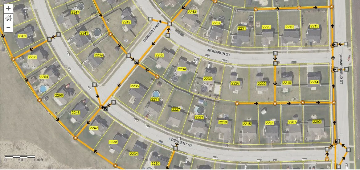
In today’s rapidly changing world, effective utility management is essential to ensure a reliable supply of services such as water, electricity, and telecommunications. Campuses such as universities, hospitals, and local governments are often overwhelmed with the amount of utilities that lie in small areas or narrow corridors. Geographic Information Systems (GIS) has emerged as a powerful tool that enables utility companies and organizations to optimize their operations, improve decision-making, and enhance overall efficiency. This blog will explore the various ways that GIS, and specifically the ArcGIS platform, is transforming the way that utilities are managed across campus, from enhancing asset tracking to streamlining field operations and improving disaster response.
Tracing a Path from the Utility Network to Experience Builder
The following videos will walk you through creating and saving trace configurations, publishing them in a web map, and consuming them in ArcGIS Experience Builder with the new beta Utility Network Trace widget. We will also look at how you can incorporate additional widgets, namely the Text and Table widgets, to display and export trace results.
How to show Flow Direction for pipe networks in ArcGIS Online
After a few years now of ArcGIS Online, there is still no support for non-simple line symbols. This means for utilities, or streams, routes or whatever line features you may be managing, you cannot easily display them with flow direction arrows as in Desktop. Please Note: Those with access to ArcGIS for Server can certainly publish map services that will support this type of symbology and can be displayed through ArcGIS Online. However there are probably many that do not have that option, so in this post I'll discuss a one method as a work-around to solve this...
Leaving a legacy: Preventing the loss of Tribal Data.
As employees accumulate years on the job, they begin to build up an internal database of information. A common term for this is Tribal Knowledge. Tribal knowledge is used to describe the wealth of data that a long time employee has developed, obsorbed, and retained over time. This is a fantastic resource for your organization which can....


