The Illinois Statewide 9-1-1 Administrator has released information for FY2025. There is $12 million available for funding GIS projects with a submission deadline of February 20th, 2024. The grant now covers the creation of indoor school (K-12) map data layers, while still supporting projects for required GIS data layers. The state’s prioritization of Indoor school mapping is an exciting development that Cloudpoint fully supports. Cloudpoint has already developed incredible Indoor data for schools and we are ready to assist Illinois PSAPs in vastly improving their school building emergency data.
Help for the Helpers: NG9-1-1 GIS Grants
Funding Updates
So much goes into transitioning a 911 system to NG911, from changing state policies to buying appropriate equipment to updating GIS data. This upgrade comes with a large price tag. There are a lot of variables and scenarios were calculated in the report to Congress, but we’re talking in the ballpark of $14 billion dollars nation-wide. Available funding varies widely by state, but…
Showing off GIS in the Show-Me State
Daniel and I made it back earlier this week from presenting and exhibiting at the Missouri Public Safety Communications Conference (MPSCC) in Branson, MO. As the push for Next Generation 9-1-1 services throughout the United Sates continues, Missouri sits primed and ready for help with their GIS data.
On Wisconsin: WLIA 2022 Annual Conference Recap
It all started on chilly Wednesday morning. Cloudpoint packed up the van and headed towards Elkhart Lake WI and the WLIA 2022 Annual Conference. On the way, however, we couldn't pass up the opportunity to do some business. After a quick lunch, Hunter and Erin met with the public works department of the city of Zion IL.
Not getting out lately??? Don't worry, we'll come to you!
Our team at Cloudpoint Geospatial has been busy planning a record year for our company in attending, exhibiting, lecturing at, and even hosting GIS events. “It’s expected to be a breakout year for us in multiple ways”, says company founder and CEO, Jonathan Hodel. “Our business development team has gone above and beyond with their strategic planning efforts this year, having over fifty…
Cloudpoint's 2021 Year-in-Review
New GIS Webinar Schedule Released for 2021
Chicagoland NG9-1-1 Dispatch Organization Receives Data Audit
Tazewell County 9-1-1 Receives GIS Data Upgrade
Late last year, the Tazewell County ETSB contracted with Cloudpoint Geographics to provide GIS Data Cleanup and Configuration in preparation for NG9-1-1. The contract includes the following major components that will be configured and delivered through Esri’s ArcGIS platform including ArcGIS Online for communities to submit updates to road centerline and address data.
Data Assessment to review existing data and analyze errors
Integration of GIS updates with the Client’s CAD (Computer Aided Dispatch) system
Coordination with local agencies to incorporate local GIS data layers
Building structure points layer with classification
Spatial updates to road centerlines and address points
Correcting topological errors in boundary layers
Converting data format and spatial reference to State of Illinois’ NG9-1-1 Data Standards
Setup & integration of Enterprise GIS for data exchange with local agencies
Ongoing GIS data maintenance
The results of this project will assist Tazewell County 9-1-1 dispatchers and emergency responders by improving data accuracy and increasing efficiency in response times. Additionally it will provide increased communications between the county 9-1-1 and local addressing authorities. For more information regarding Cloudpoint’s NG9-1-1 GIS data services please contact us or visit our NG9-1-1 services page.
Scott County receives GIS Data cleanup for NG9-1-1
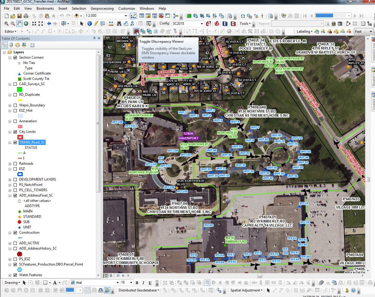
When Scott County, Iowa had a recent opportunity to secure grant funding to provide GIS data cleanup for NG9-1-1 they took full advantage and contract with Cloudpoint to compete this work. The project had a very tight time frame being completed in less than 60 days. This work involved cleanup of Emergency Service boundaries in the GIS, as well as repairing road centerline geometry, correcting road centerline address ranges, directional errors in digitize roadway directions, and reviewing site address data points that fell out of range with the centerlines. Cloudpoint was able to complete this cleanup work using tools including curves-to-lines in ArcGIS Pro, creating topologies, and using the 'Align To Shape' tool for aligning emergency services boundaries with road centerlines and administrative or political boundaries where applicable. Overall the project involved a over of 88,000 address points and more than 2,300 centerline miles. Cloudpoint continues to provide high quality GIS data services for state and local governments throughout the Midwest. For more information contact our office at 877-377-8124.
A screenshot of address points, road centerlines, and emergency services boundaries requiring review and data cleanup for improving emergency response and dispatch for NG9-1-1 services in Scott County, IA.


