
So you don’t know Matt Supert at the Village of Western Springs? Well you came to the right place to learn more. Matt serves as the…
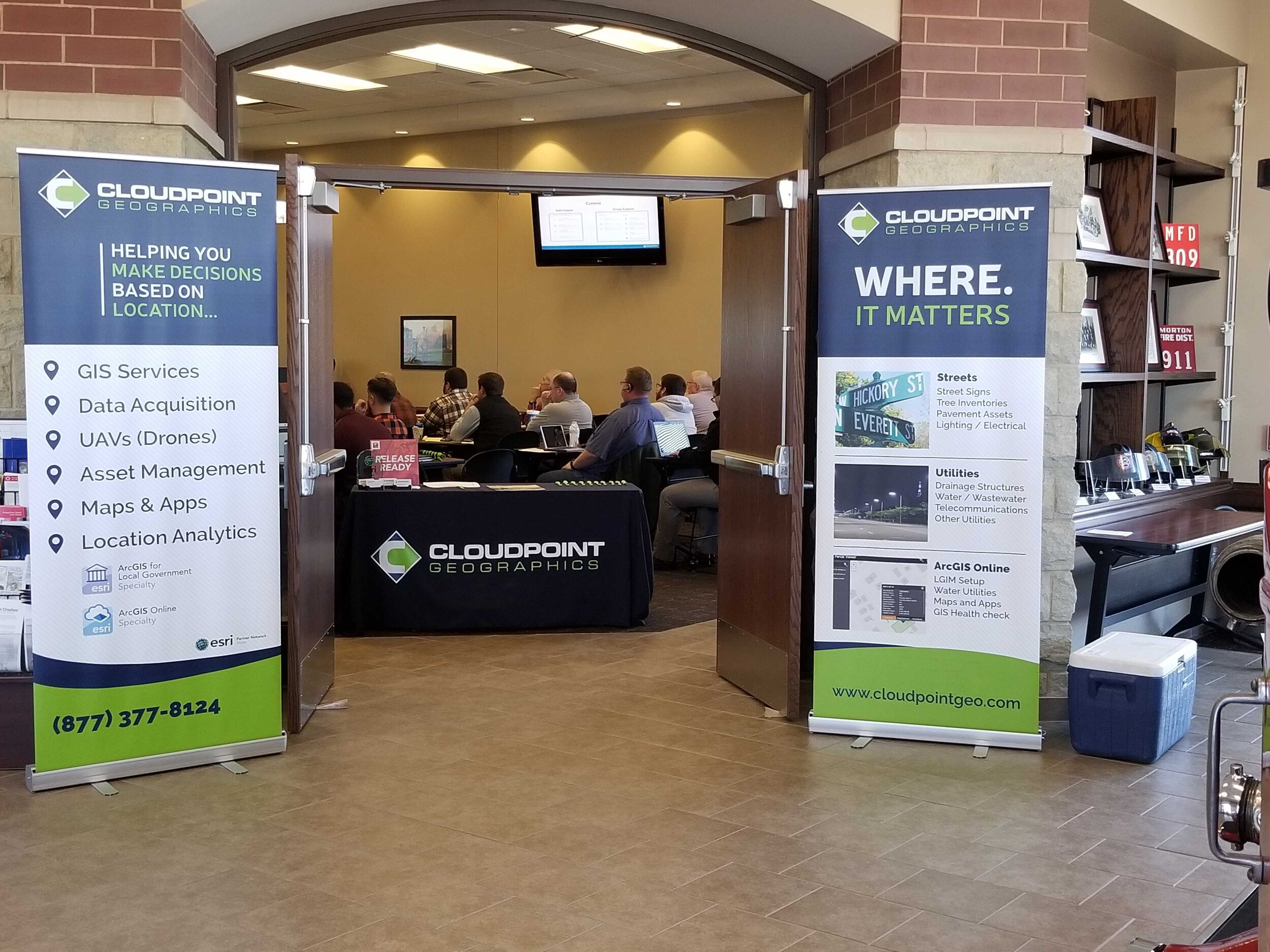
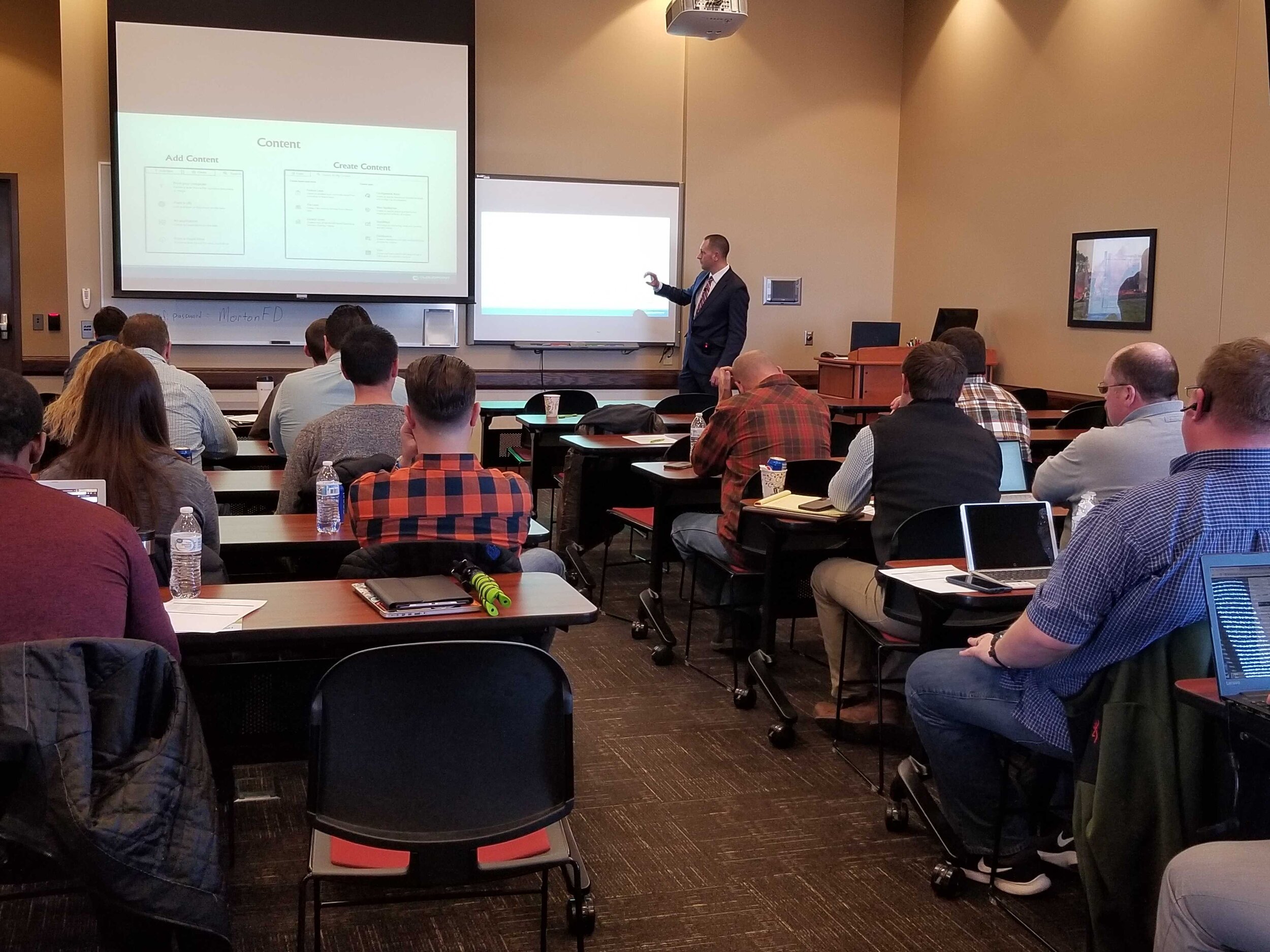
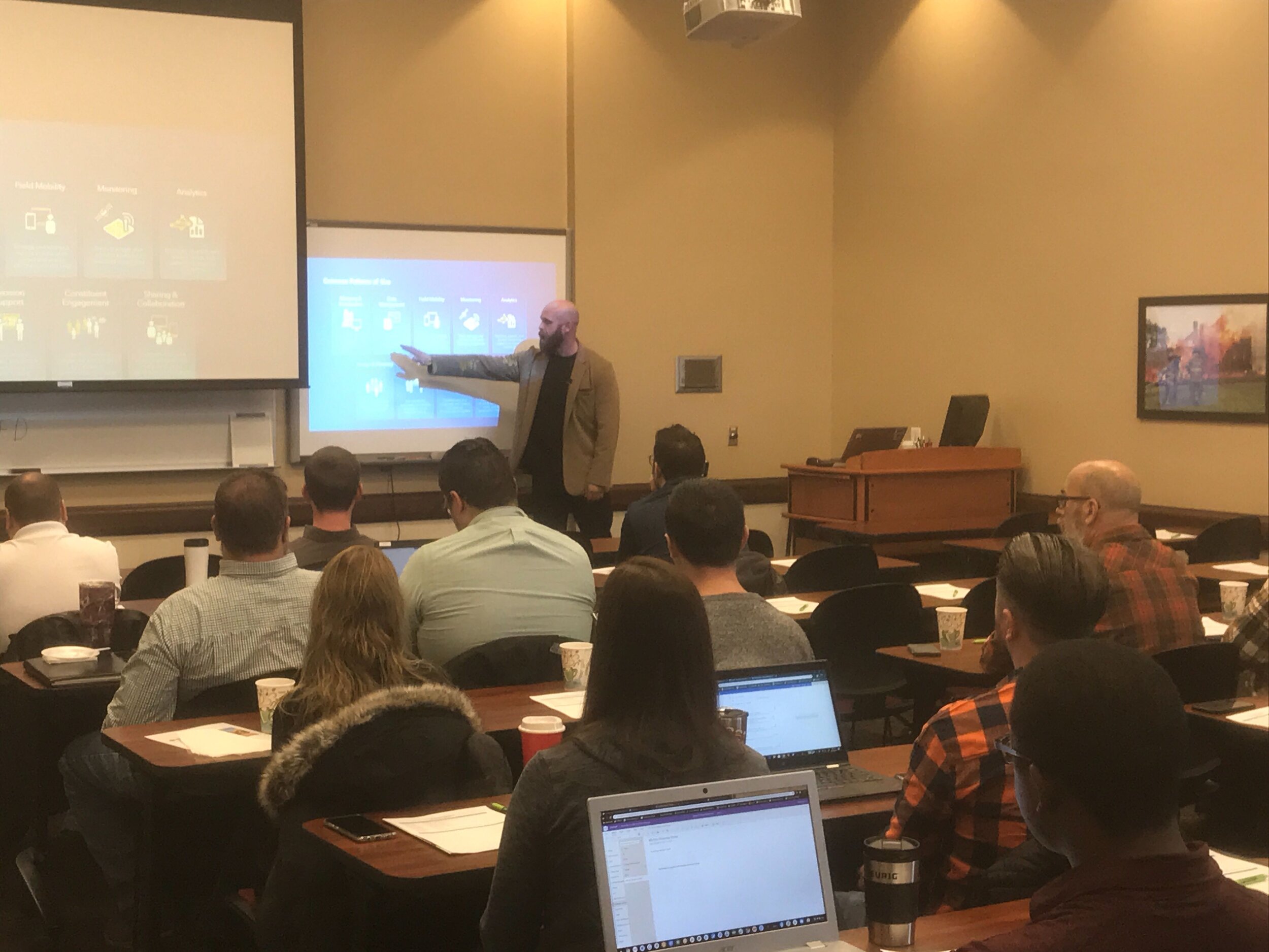
Cloudpoint Event Recap: Morton Showcase 2019
Last Friday we had the opportunity to once again gather with local government professionals throughout the Central Illinois area for the ArcGIS Solutions Showcase. Attendees traveled from as far as Galesburg , Watseka, Ottawa, and Decatur to learn about the latest solutions from Esri and pickup on some training tips for ArcGIS Online, Indoors, Hub, Dashboards, and Pro. Below are a few photos of the event. Videos of the showcase are coming soon on our Youtube Channel! This was the first time this event was captured in video recordings so please be sure to check those out in case you missed the live event. Special thanks to Mitchell Winiecki from Esri for getting the creative thinking juices flowing, and guest speaker, Glen Wetterow, GIS Coordinator for the City of East Peoria for presenting on new ways their organization is using GIS technology. To find out more about past or future showcase events visit: https://www.cloudpointgeo.com/showcaseevents
Chicagoland NG9-1-1 Dispatch Organization Receives Data Audit

Village of Burr Ridge receives a GIS face lift!

Burr Ridge is home to over 500 businesses occupying more than 6 million square feet of floor area and employing 10,000 plus people.
The Village of Burr Ridge has contracted with Cloudpoint Geographics to provide complete managed GIS services. Cloudpoint's professional staff will act as an extension to the Village's internal staff when it comes to GIS needs and communicating with its constituents. Here are some resources that the Client will soon be able to take advantage thanks to this newly formed partnership.
ArcGIS Online
Address Buffer Tool
Street Light Collection
Village staff had the foresight to see that a centralized GIS can be a "single source of truth" for both internal and external users to access critical information to help drive decision making processes. The Cloudpoint team will be working closely with the finance director, assistant administrator, public works officials, and IT staff to remotely connecting to the Village's network to perform GIS upgrades and rolling out new applications for the system as well as providing regular training for their staff. For more information on how your agency can take advantage of our affordable GIS services you can contact us through our website or call 877-377-8124.
Cloudpoint Aerial Maps Cog Hill Golf Course
Cloudpoint Geographics is excited to announce another UAV drone mapping project that is in the works. We will be collecting data at Cog Hill Golf Course in Lemont, IL. Some of you golfers out there are familiar with Cog Hill, but for you other folks, Cog Hill is comprised of 4 separate courses and has hosted numerous Professional Golf Association events including 16 Western Opens and 4 BMW Championships. We will be collecting ground control points and high resolution imagery that allows us to create 3D mapping for various applications. This is the 2nd golf course that we have flown and we're pretty certain it won't be the last! It's a good thing we're mapping the golf course, because that's what we do. If we were golfing at Cog Hill, there'd be several lost balls and more than a few announcements of "FORE!"
Watercon Pre-Conference Video
We'll See You In Wisconsin!
Customer Spotlight - Cassidy Killian, GIS Coordinator, Normal, Il

Cassidy has been the GIS Coordinator for the Town of Normal for 8.5 years, it will be 9 in May. Before this current GIS position he worked with SAIC in St. Louis on NGA projects with 'Top Secret' clearance. Since he graduated from Illinois State University's Geography program, working for the Town was something of a homecoming for him.
There are many bright spots in working for Normal (aside from the many jokes). One is being able to hire great staff from just down the block at ISU, like GIS technician Daniel Moore. He says his biggest challenges lie far outside City Hall: "It's tough to keep up with the pace of Esri's changes". Something we all struggle with. To do that Cassidy has a steady diet of Online training, Seminars and Conferences including the massive User Conference during the summer.
Lately, GIS at the Town of Normal has been picking up the pace. Much of the utilities data is now fully digitized. That allows their digital infrastructure to be edited and checked out in the field on connected devices. "Implementing the Sanitary Server Master Plan forced us to push data out to the field," said Cassidy. With a series of iPad Minis and Trimble Geo 7s field folks can view, edit, and maintain their digital infrastructure as it exists while still onsite. This includes the new geometric network that the water system has courtesy of Cloudpoint Geographics.
There are plans to use a newly installed version of ArcGIS Geoevent Server to help field vehicles become an efficient fleet. In addition to the aforementioned applications, Cassidy is in the midst of creating GIS tools to be used by the park district and other municipal departments. With an Esri Enterprise Agreement, the GIS team at the Town of Normal are only limited by their imagination.
ESRI Water Conference 2016
Last week I had the pleasure of attending the 2016 ESRI Water Conference in Austin, TX (not a bad place to be in February). This was the second annual iteration of the conference, and this year they included not only utilities, but also water resources. And I think that was an interesting move, to expand the scope to a broader look at the water cycle.

Naturally there were a plenty of interesting GIS uses and technologies showcased from streamflow and flood prediction to a growing number of mobile applications. Primarily interested in the keeping up with the latest ESRI has to offer, I got the most excitement out of the upcoming releases of applications like Collector and Survey123, and the news of development for a new Utility Network Model. It was also pretty awesome to hear what other organizations like the City of Philadelphia are doing with the technology and water management.
Austin was a great venue and the downtown scene had plenty of great food and music. And for those dealing with water and GIS, I'd recommend this conference if you get the chance. It's a nice, more focused alternative to the UC, or early addition / sneak peak.