

Cloudpoint Geographics’ Land Records team will be providing parcel fabric migration services to the City of Rockwall, TX. The City has approximately 18,000 parcels and would like to take advantage of Esri’s most advanced parcel mapping functionality. With the new fabric they can take advantage of Plan Directory, Least Squares Adjustments, Control Points, Historic Parcels layer and more. For more information on how you can benefit from Esri’s parcel fabric please contact Cloudpoint’s Land Records team.
A Mapping Overhaul for Peoria's Springdale Cemetery
Did you know that Central Illinois’ largest cemetery has over 75,000 gravesites? And it is the final resting place of some of the most famous historical Illinoisans. When the cemetery needed an upgrade to their mapping software to ingrate a more user-friendly, web-based system, they turned to Cloudpoint Geographics.

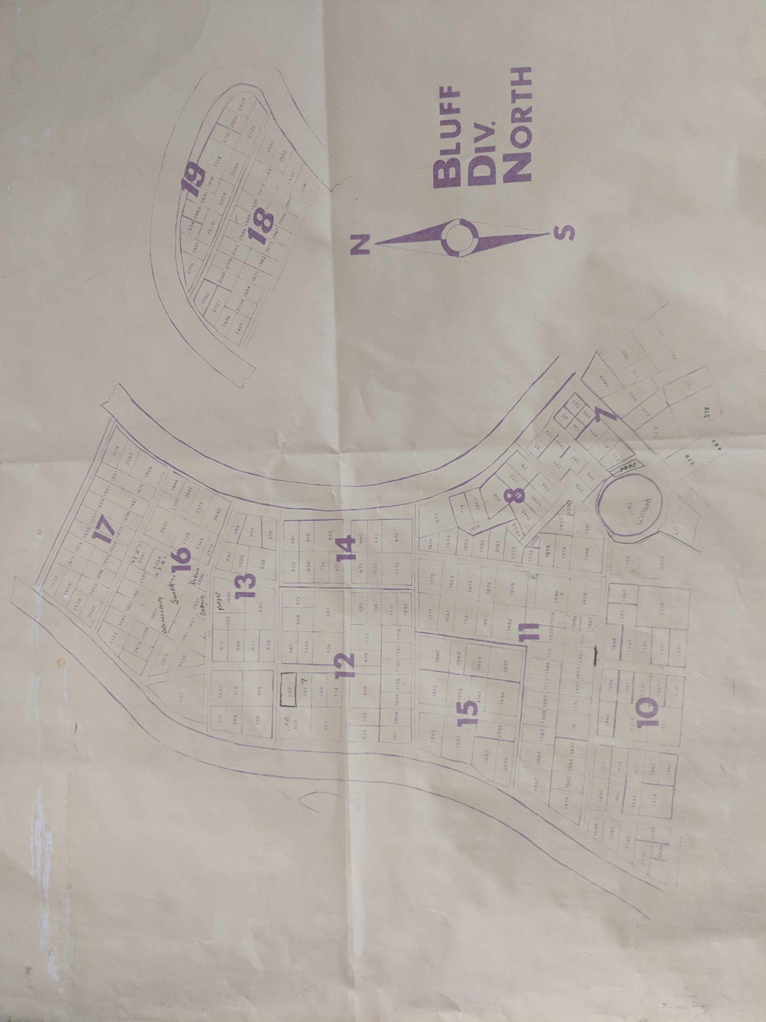
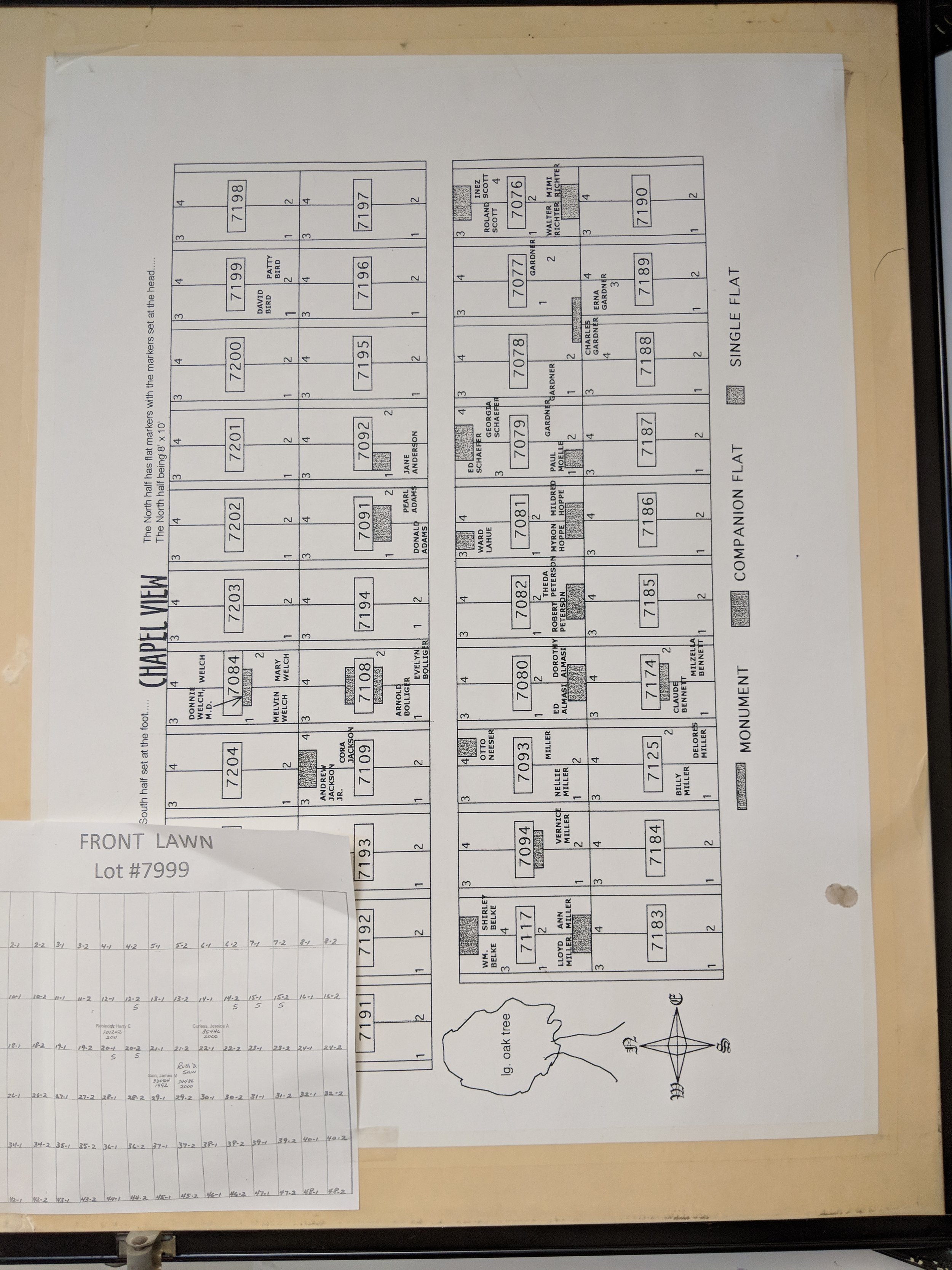
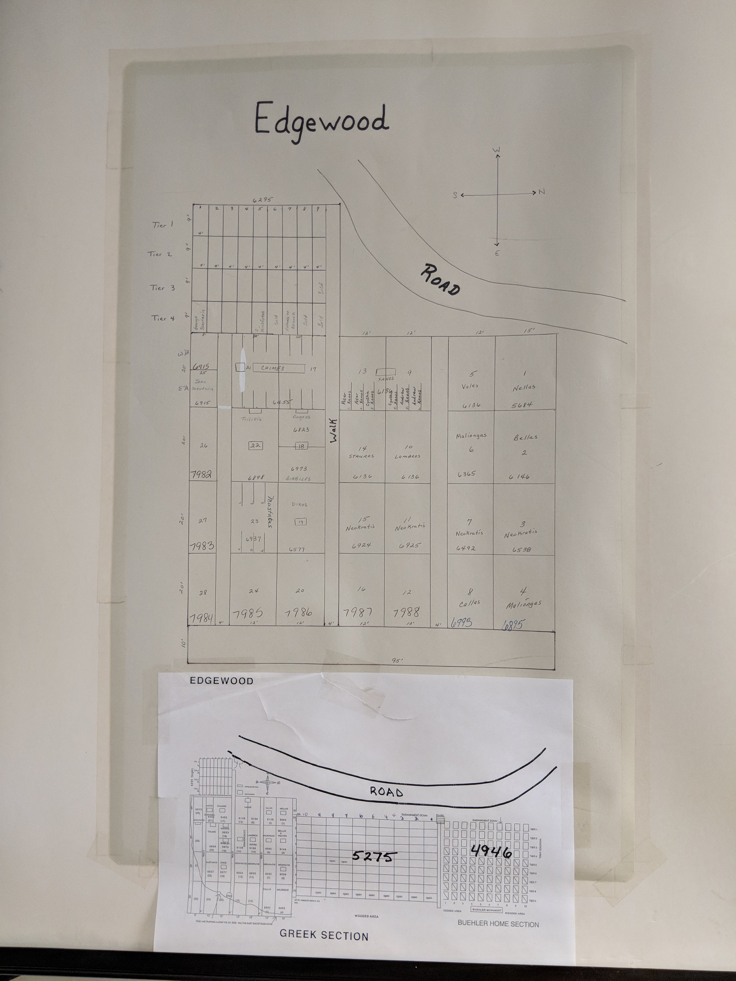
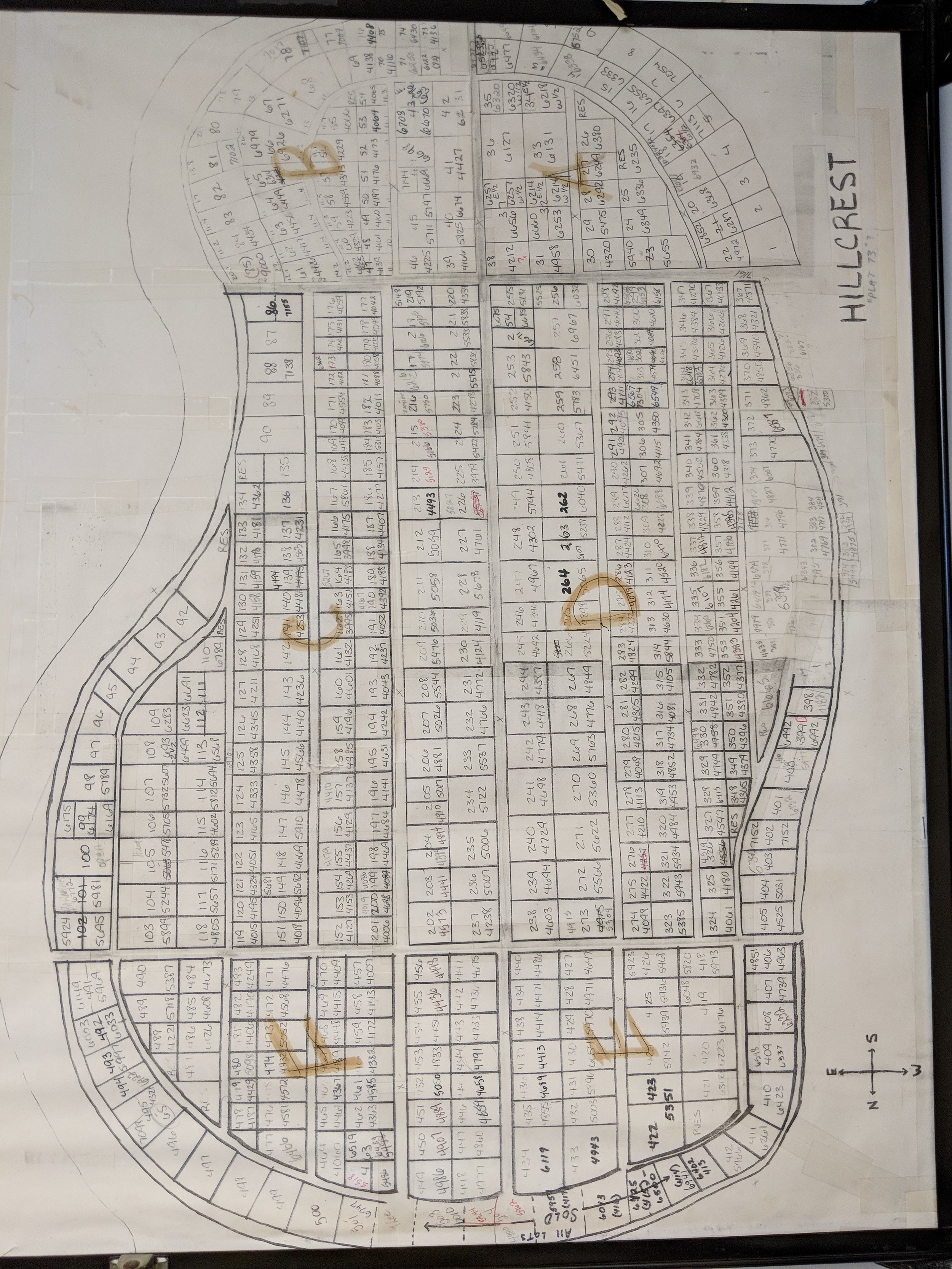
Each section of the cemetery had its own set up maps and related grave records. These historic records were manually reviewed and data entered into the new mapping system. The final application will consist of a searchable, interactive, GIS web map for cemetery managers to easily update records for burials and track lot sales.

The team was able to provide drone flights and GPS data collection to introduce high-resolution imagery onto the scene and increase spatial accuracy of all gravesites along with the various sectional layouts of the cemetery. As part of the final project the Client will be receiving an interactive web-based mapping application to easily search, edit, and updated burial records, lot sales, and ownership information for each site. In addition, Cloudpoint will be providing a public-facing web map that allows the public to search by last name to find loved ones or to support genealogical research. For more information on how your cemetery can improve data management and benefit from integrating GIS technology contact us or call 877-377-8124.
Tazewell County 9-1-1 Receives GIS Data Upgrade

Late last year, the Tazewell County ETSB contracted with Cloudpoint Geographics to provide GIS Data Cleanup and Configuration in preparation for NG9-1-1. The contract includes the following major components that will be configured and delivered through Esri’s ArcGIS platform including ArcGIS Online for communities to submit updates to road centerline and address data.
Data Assessment to review existing data and analyze errors
Integration of GIS updates with the Client’s CAD (Computer Aided Dispatch) system
Coordination with local agencies to incorporate local GIS data layers
Building structure points layer with classification
Spatial updates to road centerlines and address points
Correcting topological errors in boundary layers
Converting data format and spatial reference to State of Illinois’ NG9-1-1 Data Standards
Setup & integration of Enterprise GIS for data exchange with local agencies
Ongoing GIS data maintenance
The results of this project will assist Tazewell County 9-1-1 dispatchers and emergency responders by improving data accuracy and increasing efficiency in response times. Additionally it will provide increased communications between the county 9-1-1 and local addressing authorities. For more information regarding Cloudpoint’s NG9-1-1 GIS data services please contact us or visit our NG9-1-1 services page.
Village of Burr Ridge receives a GIS face lift!

Burr Ridge is home to over 500 businesses occupying more than 6 million square feet of floor area and employing 10,000 plus people.
The Village of Burr Ridge has contracted with Cloudpoint Geographics to provide complete managed GIS services. Cloudpoint's professional staff will act as an extension to the Village's internal staff when it comes to GIS needs and communicating with its constituents. Here are some resources that the Client will soon be able to take advantage thanks to this newly formed partnership.
ArcGIS Online
Address Buffer Tool
Street Light Collection
Village staff had the foresight to see that a centralized GIS can be a "single source of truth" for both internal and external users to access critical information to help drive decision making processes. The Cloudpoint team will be working closely with the finance director, assistant administrator, public works officials, and IT staff to remotely connecting to the Village's network to perform GIS upgrades and rolling out new applications for the system as well as providing regular training for their staff. For more information on how your agency can take advantage of our affordable GIS services you can contact us through our website or call 877-377-8124.
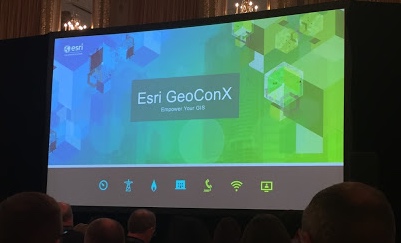
GeoConX In Chicago
Esri has their mammoth User's Conference every year in San Diego. See Joe's review of that. In an attempt to accommodate specific industries, they also hosts a few much smaller events across the country throughout the year.
This year the gas, electric & telecom conference, named GeoConX (pronounced geo-connects) was hosted in Chicago. With our client base and perfectly aligned conference in our backyard. both Micah and Paul attended.
Here are some highlights:
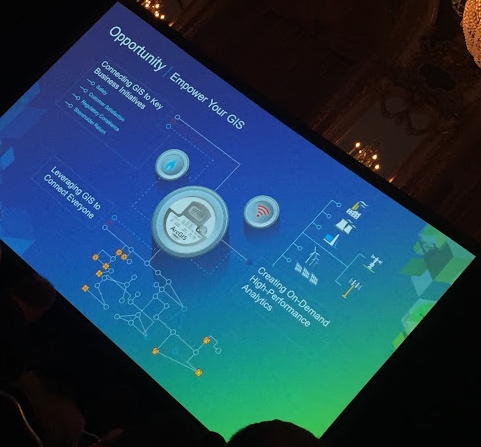
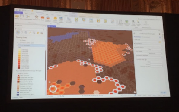
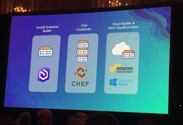
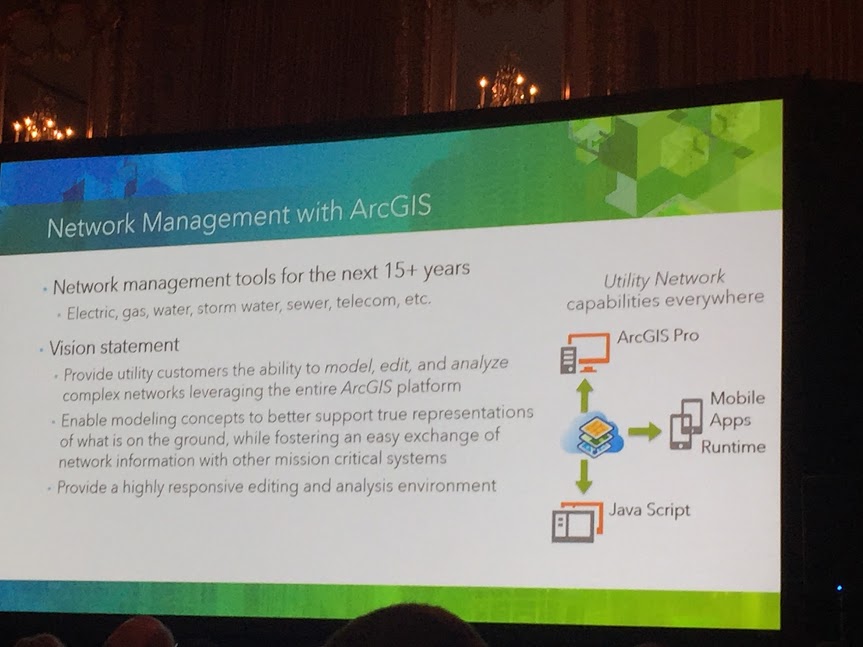


We were happy to attend at the behalf of our gas, electric and telecommunication clients. There is much to look forward to in the upcoming technology. Notably an entirely new Utility Networking system built to last, Attribute Validation Rules, Survey123 working with Collector & Workforce, ArcGIS Enterprise Builder, Web-based Dashboards, Hexagon Bins ... Well lets just say it was all notable.
Ask us more!
Is your Address Data ready for NG9-1-1?
Do you know the quality of your address data in your GIS? Did you also know that the accuracy of this data is of critical importance for the future of NG9-1-1? As an Esri business partner, Cloudpoint Geographics understands the value of ArcGIS Solutions for Local Government, including address data management, and has been implementing these solutions for several years. Our professional staff has the ability to review the quality of your road centerline address ranges, as well as a review of your road names in accordance with standards from the USPS to provide you with a rating score on the quality of your data. In addition they will make recommended updates and provide a cost estimate associated with such updates. The following are just a few solutions powered by Esri's Local Government that the Cloudpoint team can implement for you:
Data Reviewer for Addresses
Address Data Management
Address Crowdsourcing
Address Field Verification
Community Addresses

Our local government experience in building GIS solutions on the Esri platform helps us offer value-added services to agencies needing a professional solution in a timely manner. Don't wait for Next Generation 9-1-1 to come to you, make the effort to be prepared. For more information on pricing contact us at 877-377-8124 or submit below.
